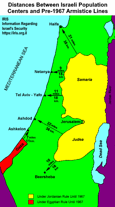
The map below shows how Israeli population centers were literally under the gun — within easy rocket and even artillery range — from enemy borders before 1967. And would be again if captured territories were returned to the Arabs, as happened in Gaza in 2005.
Another map shows the borders of the regions under the jurisdiction of Yasser Arafat’s Palestinian Authority.