Israeli Proposal to Palestinians:
Eilat Talks, May, 2000
The map below represents the Barak government's proposed territorial settlement, as presented to the Palestinians during the talks held in Eilat, May 2000. (Map from Yediot Aharonot, May 19, 2000.)
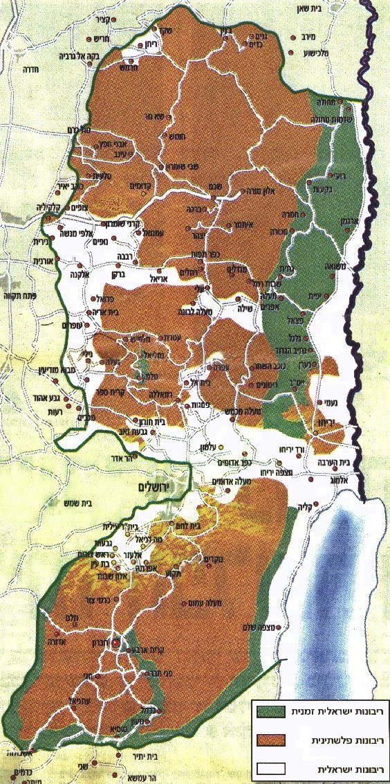
| The dark green areas would temporarily remain under Israel sovereignty. |
| The brown areas would be be granted full Palestinian sovereignty. |
| The white areas would be annexed to Israel. |

News you can use from Israel.
Join our Free mailing list!
Home Israel Blog Disengagement Terror Charts Security Maps Israel Size Maps PLO Background PLO Quote Sheets Did Israel Offer Too Much? About IRIS Contact Us Web links
Copyright © 1998-2025 Information Regarding Israel's Security